Water volume change in the lower Mekong from satellite altimetry and imagery data
Résumé
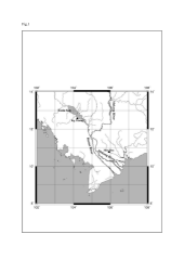
We have analysed satellite altimetry data from the ERS-2, ENVISAT and Topex/Poseidon satellites to construct water level time series over a 8-year period (from April 1996 to April 2004) over the lower Mekong River basin. The study area includes the Tonle Sap Lake, seasonally inundated areas and several branches of the hydrographic network of the Mekong delta. We found a very strong seasonal signal over the main river north of 13°N, the Tonle Sap Lake and Tonle Sap River, with amplitudes reaching 8-10 meters annually. We also found a clear interannual signal in altimetry-derived water level time-series. For example, year 1999 had weak floods (around 6 m amplitude), contrasting with year 2000 during which strong flood was noticed (around 10 m amplitude). Southward, we also observed large seasonal fluctuations (2-3 m) over inundated floodplains, as identified using satellite imagery data from the SPOT-4 Vegetation instrument. Depending on the location, quite different annual amplitudes were observed, the closer to the Mekong mouth, the smaller the signal (less than 0.5 m seasonal amplitude). Using NDVI (Normalized Difference Vegetation Index) data from the Vegetation instrument, we studied the seasonal extent of flood plains in the delta. Then combining the areal extent of floods with water levels estimated from the ERS-2/ENVISAT data, we computed maps of monthly surface water volume change over six successive years (1998-2003), the period of availability of the NDVI data. Averaged over the lower Mekong basin, this surface water volume change was then compared to the total (i.e., surface plus underground) water volume change inferred from the GRACE satellite. They exhibit in phase fluctuations.
Domaines
Sciences de la Terre
Fichier principal
 Frappart_et_al_GJI_2006_Figures-part1_corr2.pdf (344.11 Ko)
Télécharger le fichier
Frappart_et_al_GJI_2006_Figures-part2_corr2.pdf (128.15 Ko)
Télécharger le fichier
Frappart_et_al_GJI_2006_Figures-part3_corr2.pdf (97.31 Ko)
Télécharger le fichier
Frappart_et_al_GJI_2006_corr2.pdf (246.2 Ko)
Télécharger le fichier
Frappart_et_al_GJI_2006_Figures-part1_corr2.pdf (344.11 Ko)
Télécharger le fichier
Frappart_et_al_GJI_2006_Figures-part2_corr2.pdf (128.15 Ko)
Télécharger le fichier
Frappart_et_al_GJI_2006_Figures-part3_corr2.pdf (97.31 Ko)
Télécharger le fichier
Frappart_et_al_GJI_2006_corr2.pdf (246.2 Ko)
Télécharger le fichier
Origine : Fichiers produits par l'(les) auteur(s)
Origine : Fichiers produits par l'(les) auteur(s)
Origine : Fichiers produits par l'(les) auteur(s)
Origine : Fichiers produits par l'(les) auteur(s)